 Alberta
Holy Cross Mountain
Introduction
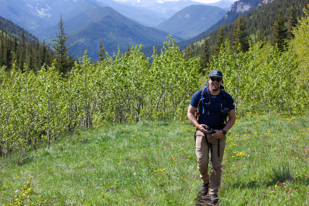
Holy Cross is a 2650m peak nestled in the southern part of Kananaskis Country in Alberta, among the first major peaks east of the Canadian Rockies, marking the transition between prairies and mountains. Despite being discreet and lesser-known, this mountain hides treasures: blooming meadows, dense forests, demanding scrambling sections, a sharp ridge, and stunning panoramic views from its summit. This adventure is recommended for seasoned mountaineers skilled in scrambling and comfortable with heights. If you are one of them, a memorable day awaits you on the slopes of Holy Cross Mountain.
3D interactive map
Getting to Holy Cross Mountain Trailhead
Parking access to Holy Cross hike: https://maps.app.goo.gl/RyL26nNr3BB658JC8
From Calgary: 125 km – 1h25 driving time
From downtown Calgary, take HWY 201 Stoney Trail West heading south. Once south of the city, take the exit towards Bragg Creek on 22X (Spruce Meadows Trail SW). Follow this road for 13km and take the left exit towards Turner Valley. After 27km, in the town of Turner Valley, turn left onto Decalta Rd and then left again 1.5km later onto 16 Ave SE. Finally, continue another 1.5km and rejoin HWY-22, turning right towards Longview. Just before entering Longview, take the right exit towards Kananaskis Country (AB-541). Follow this road for 39km to reach the trailhead.
Helpful information
To enjoy your hike, you must:
Be Equipped: Hiking boots are no longer optional but essential. A steep section of the hike through scree demands good ankle protection. Hiking poles are also highly recommended for descending over rocky terrain. A helmet is advised due to frequent rockfall. Grizzly bears are often present in the area, so bear spray is necessary as a last resort. Lastly, carry sufficient water and food.
Information: Access to Kananaskis Country is not free. You will need to register your vehicle(s) online on the Kananaskis Park website and purchase a daily or annual pass. Note that the fees are per vehicle and not per hiker, so carpooling is an option. Be mindful of the forecast and visit the park’s website before your hike to find up-to-date information such as last seen wildlife, trail conditions, etc.
The Hike
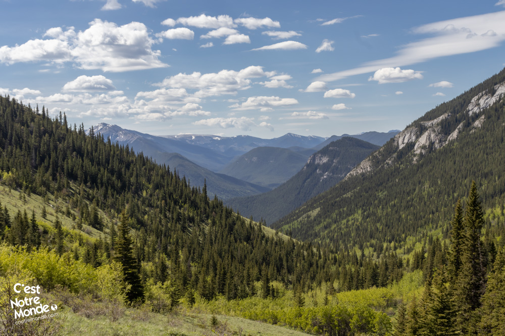
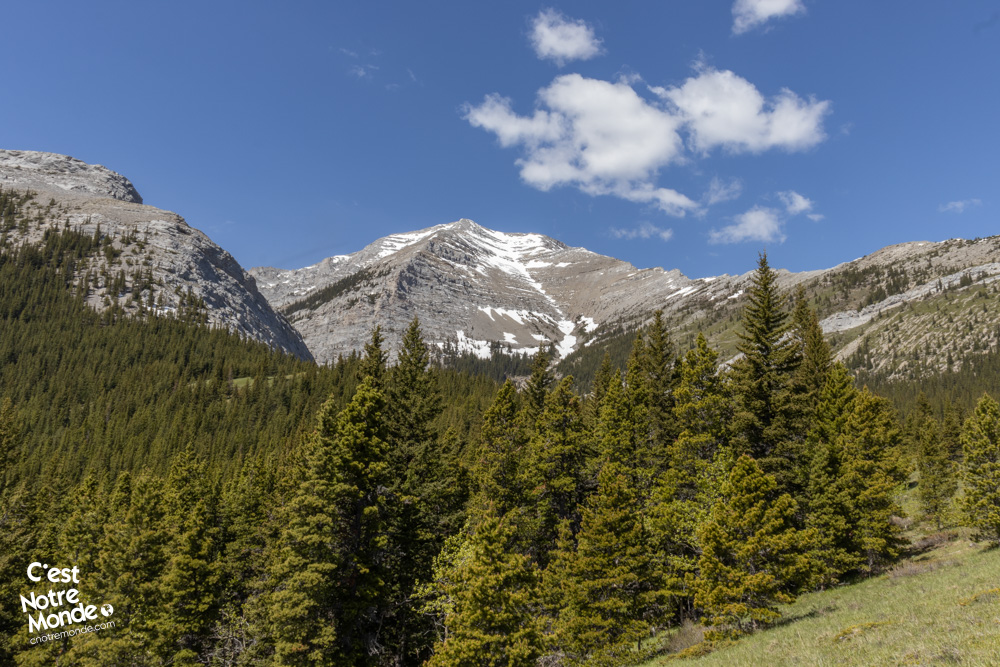
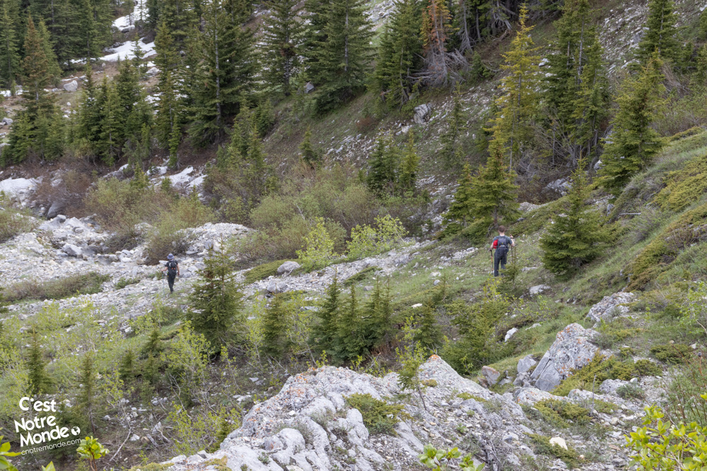
Follow the trail along the river for 3.5 km (2.19 mi). It alternates between forests and meadows, gradually ascending the entire way. The views of the valley are simply stunning, especially in the summer when the fields are covered in vibrant wildflowers. After 3.5 km, you will notice a small trail on the left, marked by an orange ribbon. Take this path, following the directions on a GPS app and keeping an eye out for sporadically placed ribbons.
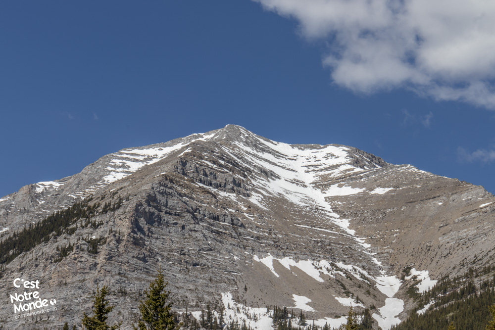
Holy Cross Mountain is a 2650m peak in the Canadian Rockies, located in Kananaskis Country, Alberta.
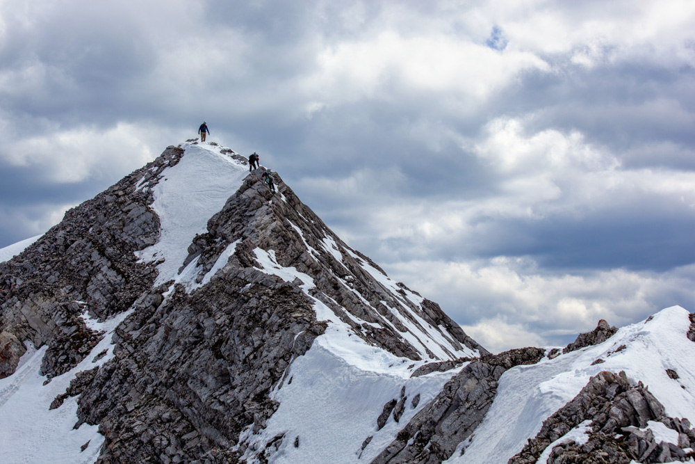
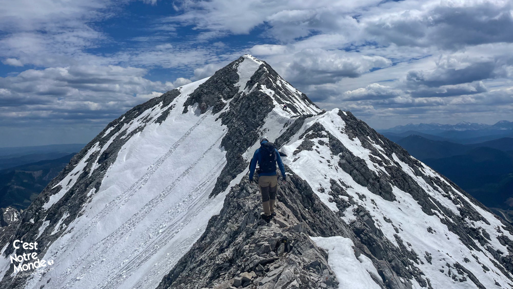
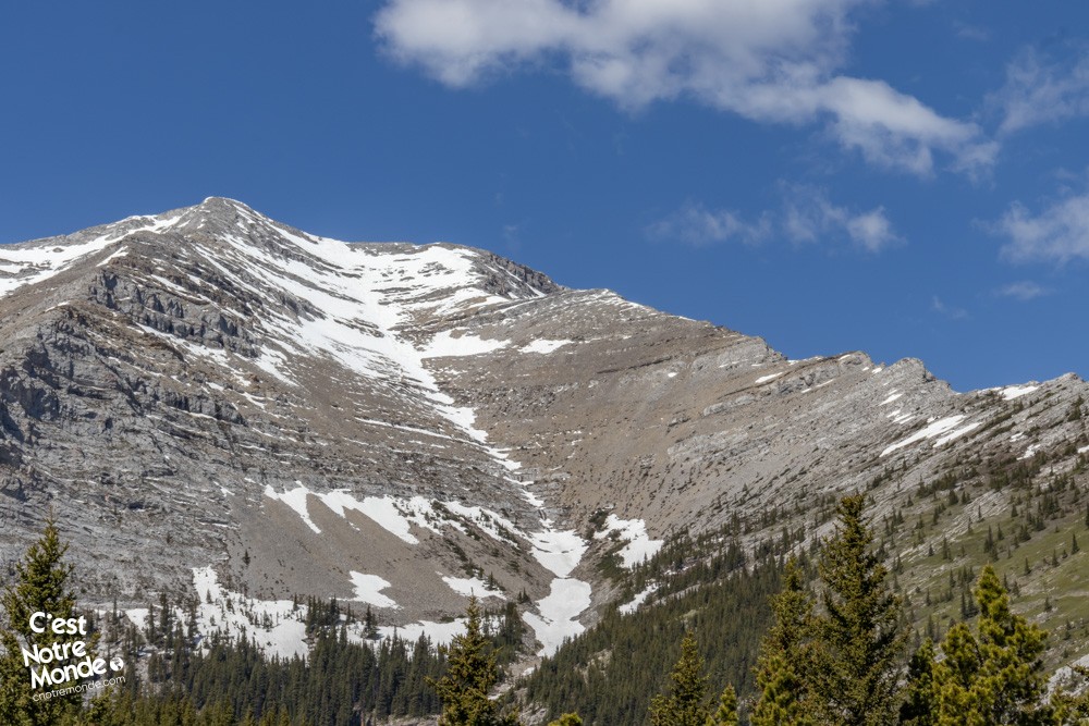
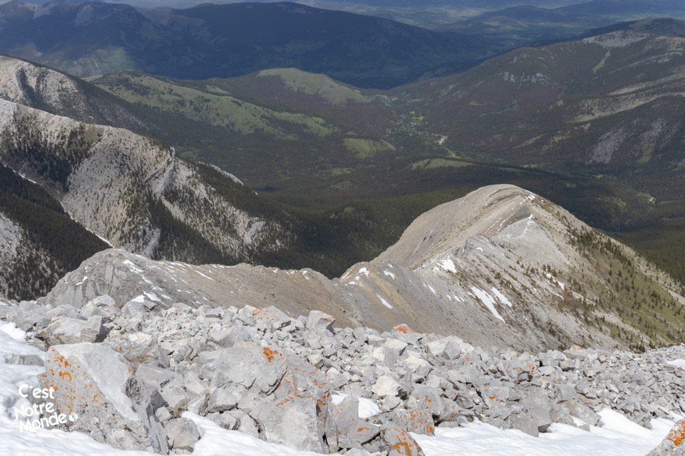
Navigating this trail can be tricky as it sometimes seems to disappear. After about 500 meters (0.31 mi), you’ll find yourself crossing a scree slope with Holy Cross Mountain in sight. From this point, you can clearly see the route to the summit as well as the return path: The ascent along the northeast ridge to the peak. The descent down the gully of the north face through a rather steep scree field.
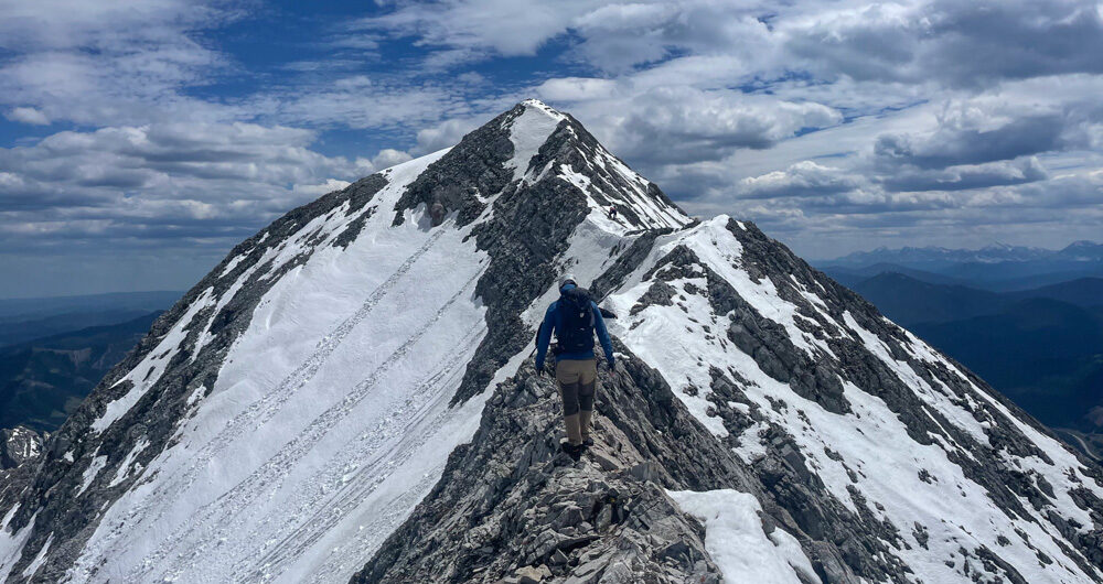
Climbing Holy Cross Mountain requires solid scrambling experience and a good tolerance for heights.
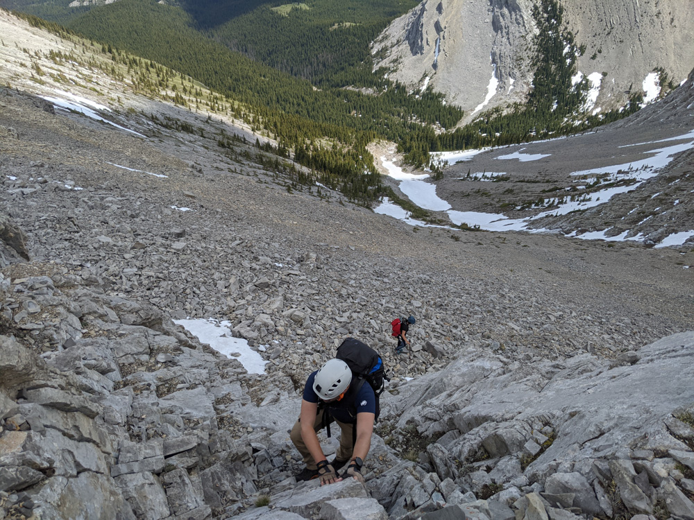
Continue following the trail down to the base of the mountain. Keep right towards the northeast ridge. This part involves bushwhacking, meaning navigating through the forest without a clearly defined trail. Start your ascent towards the ridge through the forest, then quickly emerge above the tree line onto a steep, open slope. Take your time to reach the ridge.
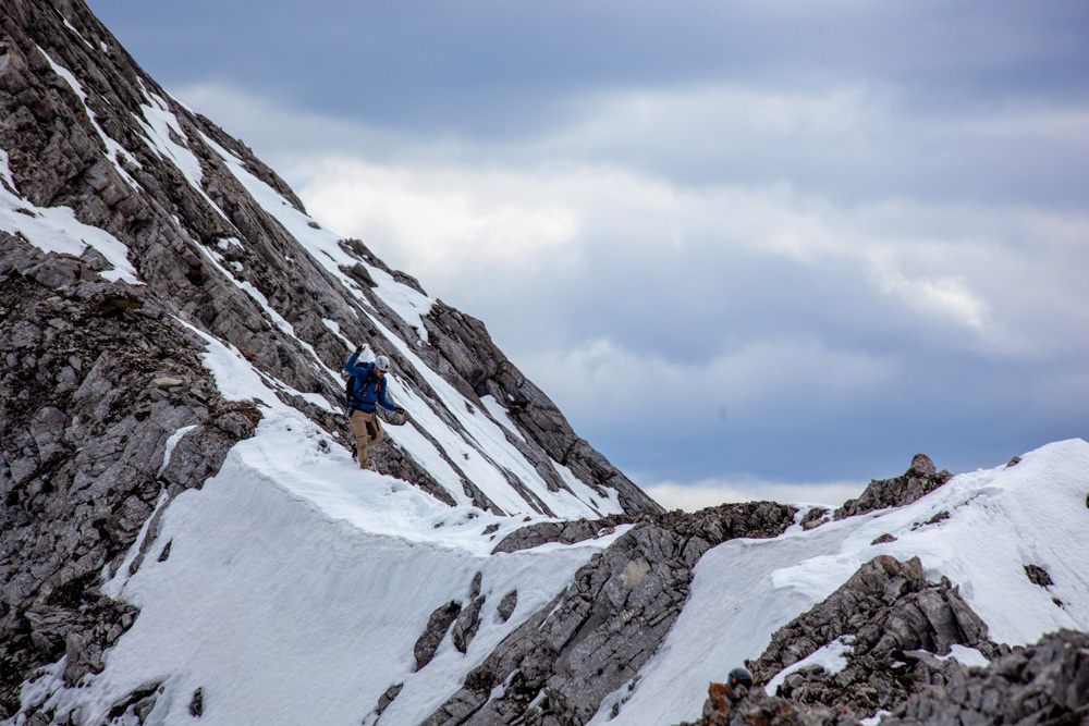
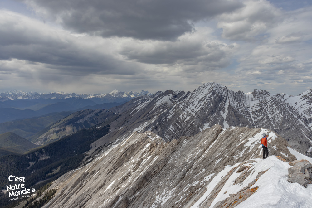
Don’t forget your helmet on Holy Cross Mountain, as there is a real risk of falling rocks.
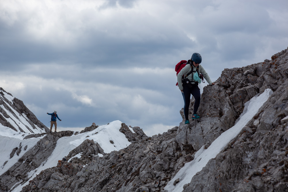
The real challenges begin here. At this point, wearing a helmet is recommended. Follow the ridge towards the summit through loose rocks and rock bands, which you may need to circumvent or climb over, depending on your comfort level. The climb to the summit ridge is long and demanding, with occasionally unstable ground. Once on the ridge, the most exposed part of the scrambling begins. Be cautious; some sections are narrow, and the risk of falling is real, especially in strong winds. Consider carefully before proceeding.
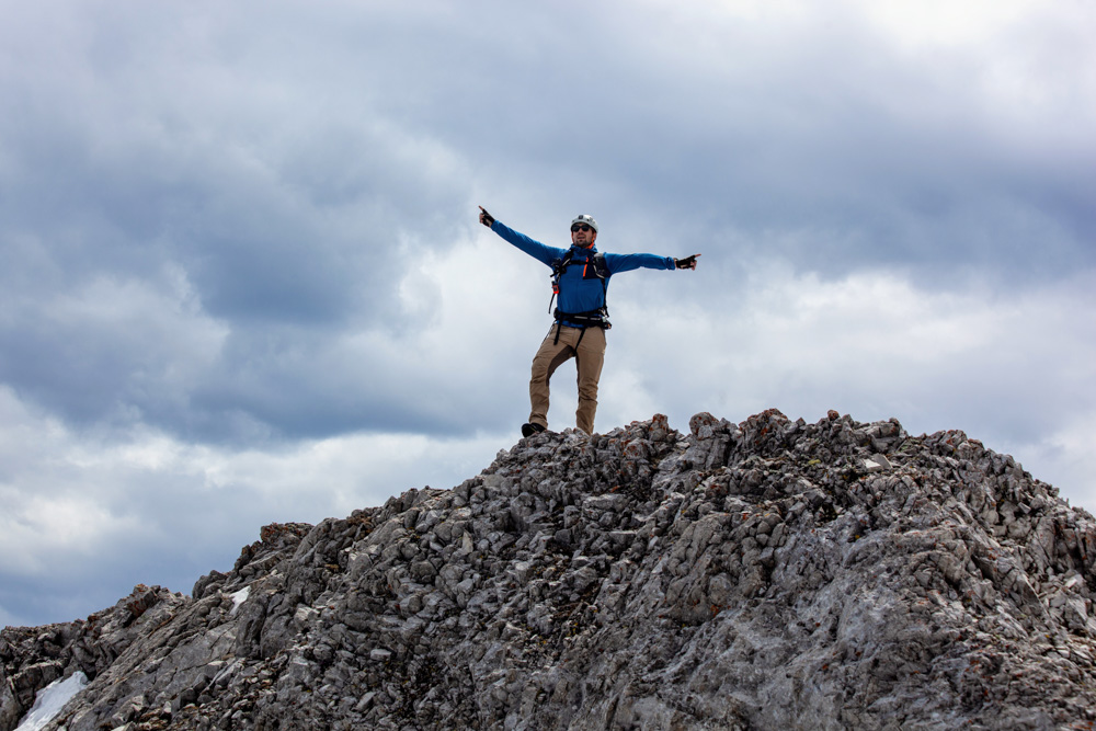
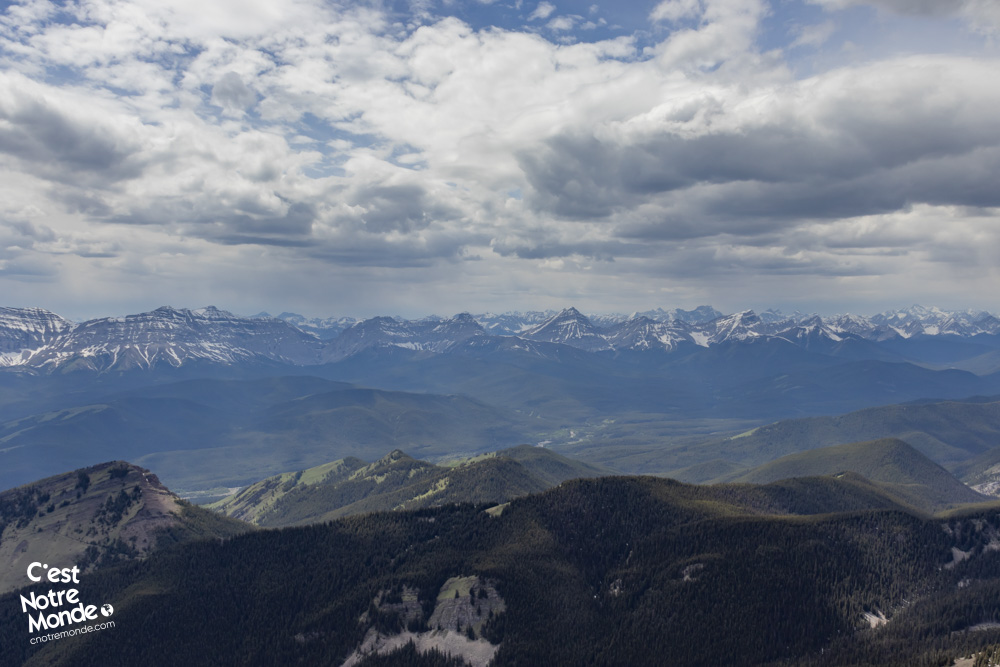
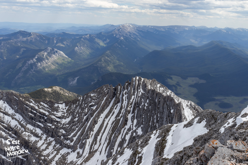
At the summit, enjoy the spectacular view of the prairies, Calgary, and the Canadian Rockies.
Just below the summit, there is a final section of scrambling before reaching the 2650 meters of Holy Cross Mountain’s peak. Then, enjoy the spectacular view of the prairies, Calgary, and the Canadian Rockies.
For the descent, we recommend following the gully to the left below the summit. It’s a typical descent through a scree field in the Canadian Rockies. Be cautious, especially if snow is present, as it could complicate the descent. Use your poles to stabilize yourself on the rocks and keep your helmet on until you reach the forest.
Once back at the base of the mountain, find the initial trail and follow the 4 km (2.5 mi) back to the road.
TO KNOW
Interest
Difficulty
Distance
Approximately 13 km / 8 miles
Duration
Around 8 or 10 hours
Elevation
2650 meters / 8694 feet
Elevation gain
Around 1300 meters / 4265 feet
Useful informations
See on Caltopo (detailed)
See on Google Maps (basic)
Useful links
Website: https://www.albertaparks.ca/parks/kananaskis/kananaskis-country/
Parking: https://maps.app.goo.gl/RyL26nNr3BB658JC8
Weather forecast: https://www.mountain-forecast.com/peaks/Mount-Armstrong/forecasts/2823
Download GPX: https://www.cnotremonde.com/gpx/Holy-Cross-AB-cestnotremonde.gpx