 Alberta
Lady MacDonald
Introduction
Lady MacDonald, towering at 2606 meters, is situated in Kananaskis Country, Alberta, just above the town of Canmore. This distinctive mountain offers two types of experiences: for hikers seeking beautiful views of Canmore, reaching the summit is optional. For scramblers in search of thrills, the goal is to reach the highest point. In both cases, the panorama during the ascent is absolutely breathtaking. The primary difference lies in the adrenaline provided by the narrow summit ridge, which only the most adventurous will attempt to cross. However, there’s no need to worry—you don’t have to traverse this ridge to enjoy the magnificent views. Whether you are looking for an adrenaline rush or simply the pleasure of a mountain hike, you will find all the tips here to conquer the slopes of Mount Lady MacDonald.
3D interactive map
Getting to Lady MacDonald Trailhead
Parking access to Lady MacDonald hike: https://maps.app.goo.gl/hrSXGxb3V9ubehV46
From Calgary: 105 km – 1h10 driving time
Take Highway AB-1 West towards Banff and exit at Exit 91 for Canmore. Turn left at the intersection, then take the first left onto Elk Run Boulevard. Continue on this road to a roundabout where you’ll turn right. Parking is immediately available on your right, along the river.
Helpful information
To enjoy your hike, you must:
Be Equipped: Hiking boots are no longer optional but essential. A steep section of the hike through scree demands good ankle protection. Hiking poles are also highly recommended for descending over rocky terrain. A helmet is advised due to frequent rockfall. Grizzly or black bears are often present in the area, so bear spray is necessary as a last resort. Lastly, carry sufficient water and food.
Information: Access to Kananaskis Country is not free. You will need to register your vehicle(s) online on the Kananaskis Park website and purchase a daily or annual pass. Note that the fees are per vehicle and not per hiker, so carpooling is an option. Be mindful of the forecast and visit the park’s website before your hike to find up-to-date information such as last seen wildlife, trail conditions, etc.
The Hike
Start of the Lady MacDonald Ascent:
Begin your ascent of Lady MacDonald by following a wide path along the river towards Cougar Creek. After about 1 km (0.6 mi), the path reaches a nearby dam (under construction in 2024) and forks to the left. It then transforms into a traditional hiking trail and starts to climb immediately.
Forest Crossing:
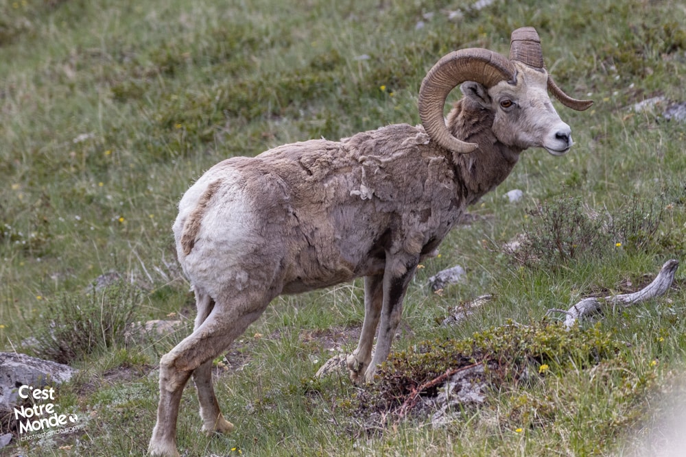
The first part of the Lady MacDonald hike takes you through a beautiful forest at the border of a wildlife protection area where access is strictly prohibited. Note that bears are frequently spotted in this area and attacks have occurred. It is highly recommended to carry Bear Spray on this trail.
Leaving the Forest and Enjoying Panoramic Views:
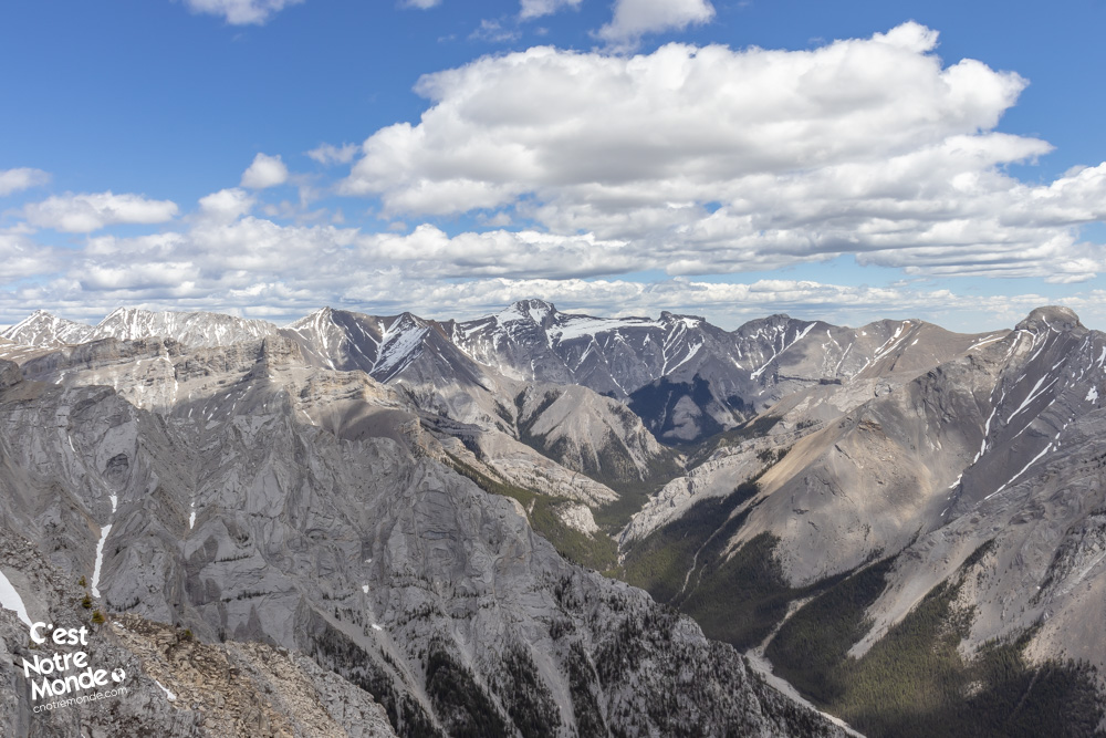
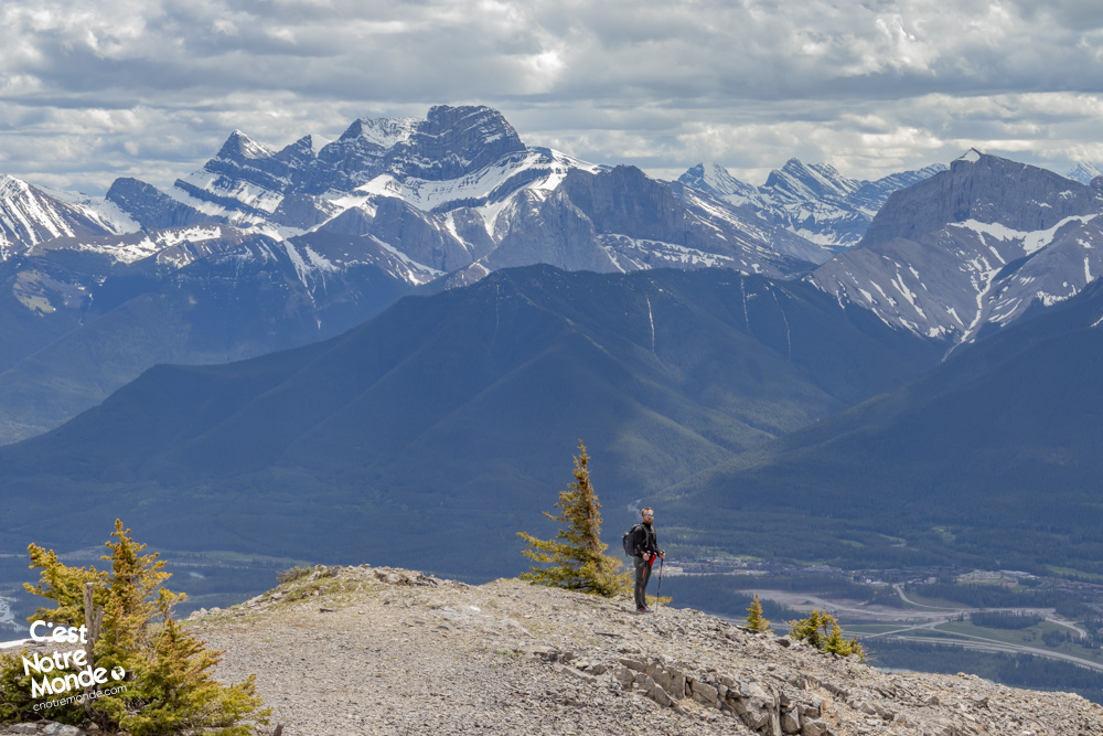
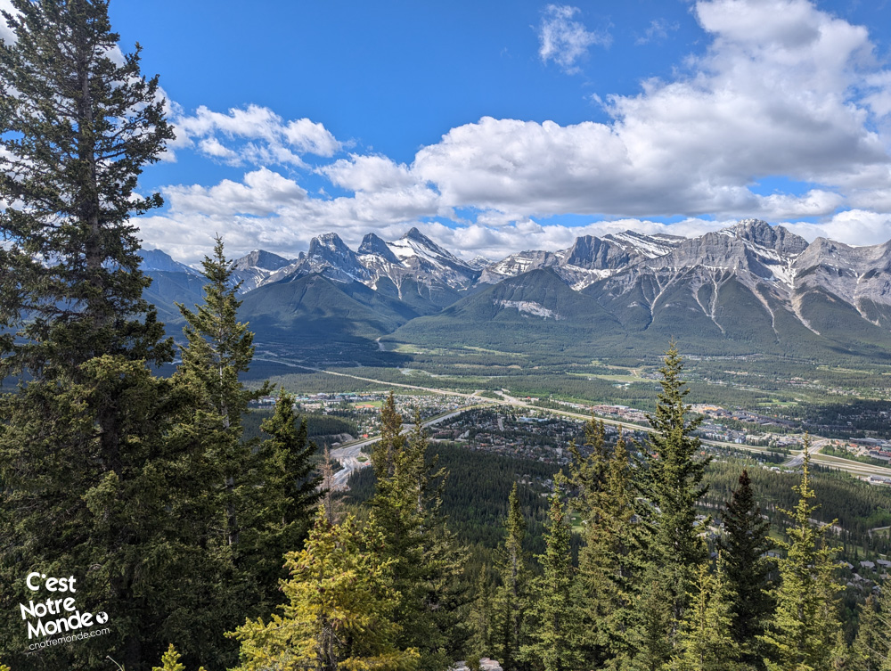
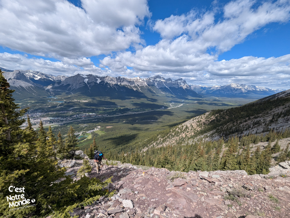
As you exit the forest, you will start to enjoy stunning views of the Canmore valley. After about 4 km (2.5 mi), you will reach a small plateau, formerly the site of a helipad. Today, only a few metal remnants remain. From this point, you can clearly see the summit and the ridge leading to it. However, there are still 600 m (0.35 mi) of walking left to reach the beginning of the Lady MacDonald ridge.
Ascent to the Lady MacDonald Summit Ridge
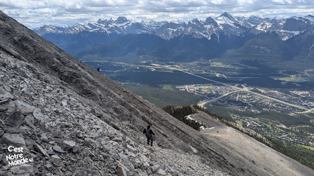
If you decide to head to the summit, you will need to climb a final wall in a field of stones to reach the ridge. This part is quite steep, and the ground is rather unstable, typical of the Canadian Rockies.
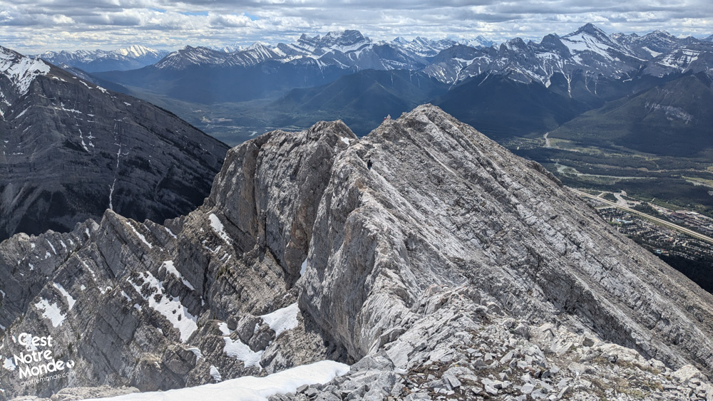
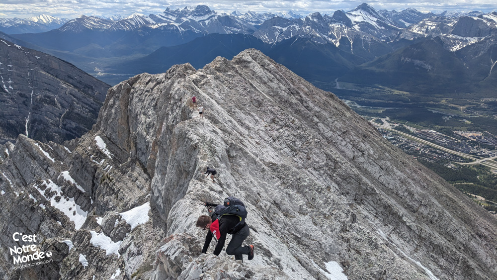
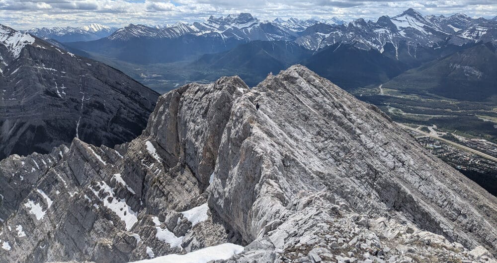
Ridge Crossing:
Once you reach the ridge, you have two options: cross the knife-edge ridge or turn back. The summit ridge is divided into two parts, with a false summit in the middle. The first part is quite exposed but manageable with caution, while the second part, finer and more exposed, descends slightly before climbing again towards the Lady MacDonald summit. This section will strongly test your nerves if you have vertigo.
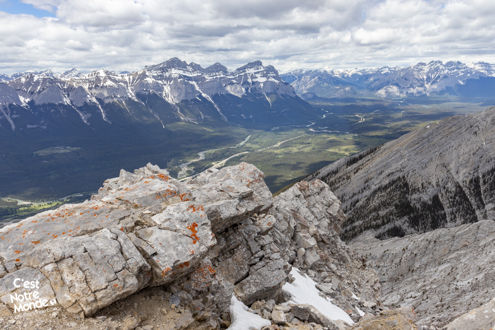
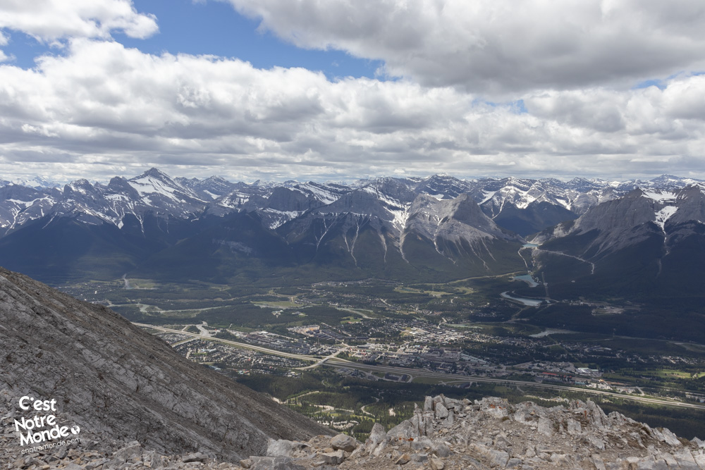
Lady MacDonald Summit Panorama:
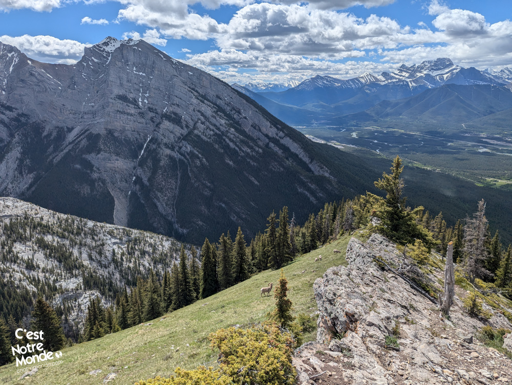
The summit and ridge of Mount Lady MacDonald offer breathtaking views of the Canmore valley, the Rundle range, Cascade Mountain, the Three Sisters (including Big Sister), and Mount Assiniboine. The panorama is stunning, whether you decided to cross the ridge or not.
Return to the Parking Lot:
The return is made by crossing the ridge again. A “shortcut” exists after the false summit, allowing you to cut through the scree field to rejoin the trail lower down and avoid the first ridge. This shortcut has very unstable ground, and rock falls are almost inevitable, so use it with caution. Once back on the main trail, retrace your steps to the parking lot.
TO KNOW
Interest
Difficulty
Distance
Approximately 9.8 km / 6.1 miles
Duration
Around 5 or 7 hours
Elevation
2606 meters / 8550 feet
Elevation gain
Around 1200 meters / 3937 feet
Useful informations
See on Caltopo (detailed)
See on Google Maps (basic)
Useful links
Website: https://www.albertaparks.ca/parks/kananaskis/kananaskis-country/
Parking: https://maps.app.goo.gl/hrSXGxb3V9ubehV46
Weather forecast: https://www.mountain-forecast.com/peaks/Mount-Lady-MacDonald/forecasts/2605
Download GPX: Lady-MacDonald-AB-cestnotremonde.gpx