 C'est Notre Monde Alpinism
Mount Cline
Introduction
Rising to 3,361 meters, Mount Cline is one of the premier peaks in the Canadian Rockies, proudly joining the prestigious 11,000ers club. Majestic and demanding, it offers a challenging ascent that includes exposed trails, glacier crossings, and airy climbs, requiring a high level of mountaineering experience.
While technically accessible, the route demands specialized climbing gear and safety equipment. This is not a climb to be taken lightly; it requires thorough preparation and, ideally, the expertise of a certified guide.
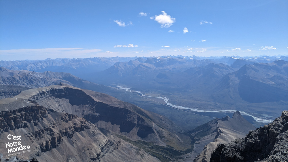
C’est Notre Monde conquered this formidable challenge in two days, with a bivouac at the summit offering stunning panoramic views. Explore all the details of this incredible adventure in our article and video!
3D interactive map
Getting to Mount Cline Trailhead
Parking access to Mount Cline ascent: https://maps.app.goo.gl/HQ8jgWtpFpav8sMD7
From Calgary: 270 km – 3h driving time
From Calgary, take the Trans-Canada Highway (AB-1 West) for 176 km, then exit onto AB-93 North towards Jasper. After passing the Canada Parks toll booth, you’ll reach the legendary Icefields Parkway, which connects Lake Louise to Jasper. Follow this road for 75 km until you reach Saskatchewan Crossing, then turn right onto David Thompson Highway (AB-11 East). Continue for 9 km until you reach the Thompson Creek Falls parking lot, located on your left. This is where the ascent of Mount Cline begins.
Helpful information
To enjoy your hike, you must:
Be Equipped: The ascent of Mount Cline is not your typical hike—it’s a true mountaineering challenge. The route crosses a glacier and navigates two notches, demanding crampons, an ice axe, rope, and expert belaying skills.
🧗 Essential gear: mountaineering equipment, crampon-compatible boots, trekking poles.
🏕️ 2-day expedition: bivouac at high altitude, with self-sufficient food and water.
⚠️ Steep and rugged terrain: a physically demanding route, suitable only for experienced mountaineers.
Mount Cline is a wild and challenging summit, requiring serious preparation and focus.
Parking: The ascent of Mount Cline begins at the Thompson Creek Falls Trailhead, located approximately 9 km past Saskatchewan Crossing. It is situated on the left side of David Thompson Highway, across from the Thompson Creek campground, heading towards Abraham Lake.
Information: Mount Cline is one of the wild peaks in the Canadian Rockies. Unlike other iconic mountains, it lies outside of national or provincial parks, within a Public Land Use Zone (PLUZ). This means there is no official trail marking or infrastructure, making the ascent more challenging. The lack of signage and the technical nature of the route require careful preparation:
✅ Study topographic maps to familiarize yourself with the route.
✅ Check weather forecasts before heading out.
✅ Consult mountaineering communities for feedback on glacier conditions and technical sections.
The Ascent
Day 1 – The Ascent to the Lakes
Thompson Creek Falls trail (3.8 km & 350m Elevation Gain)
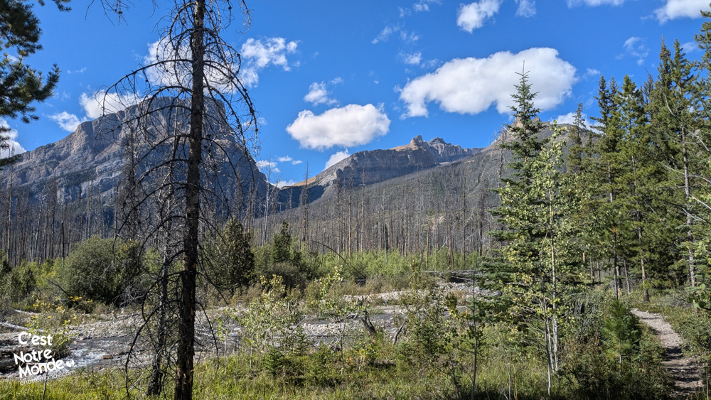
The journey to Mount Cline begins at the Thompson Creek Falls parking lot. Follow the main trail north, alongside the river. This first section is relatively straightforward and takes you to the junction where the true ascent starts.
The trail crosses the river multiple times on slippery logs, so be cautious. You’ll encounter many hikers heading to the famous Thompson Creek Falls. After approximately 3.8 km and 350m of elevation gain, a small cairn marks a turn to the right—this is where the real climb toward Mount Cline begins (see video 00:59).
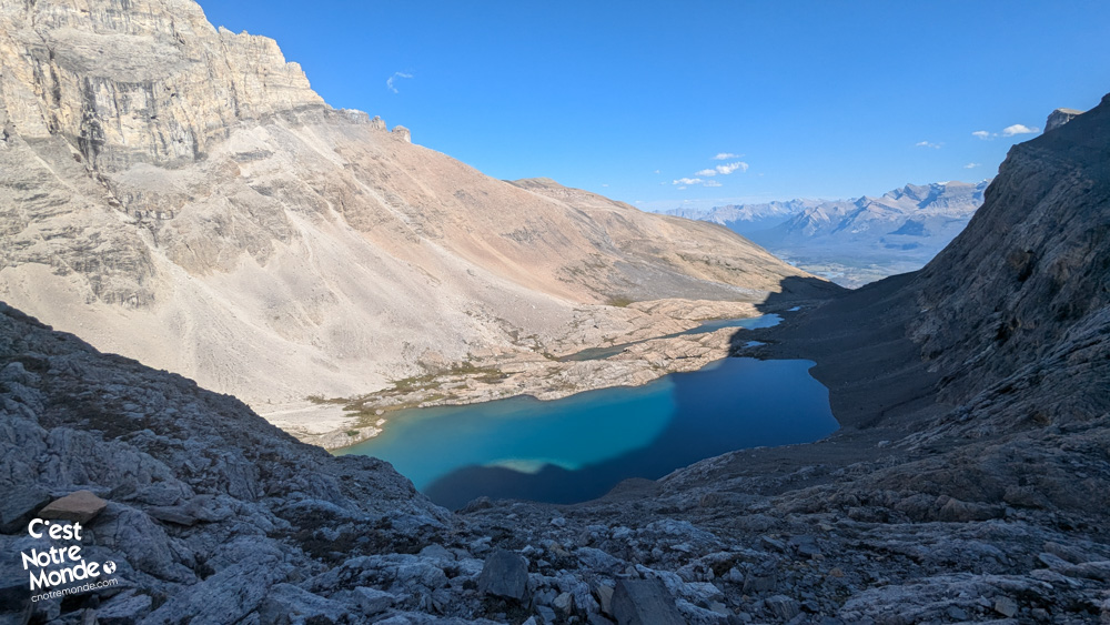
Toward the Bivouac (3.2 km & 650m Elevation Gain)
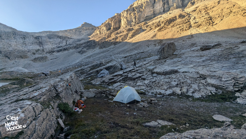
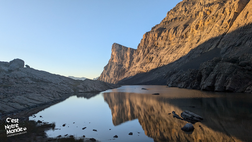
From here, the trail becomes steeper and the terrain more unstable. You’ll follow a rocky gully that needs to be crossed. Orange ribbons on trees will help guide your way. The ascent continues through a steep scree slope with some technical sections. Soon, you’ll reach a plateau with a stream leading to a stone wall. A relatively easy scramble will allow you to pass. On the other side, two beautiful alpine lakes await. This is an ideal spot to set up camp before making the final push to the summit of Mount Cline. At this point, you’ll have covered 7 km and gained 1000m of elevation.
Day 2 – To the Summit of Mount Cline (and back)
Hiking to the Glacier (2.5 km & 540m Elevation Gain)
On the second day, pack a lighter bag with essential mountaineering gear: crampons, ice axe, warm clothing, food, and water. Leave your bivouac near the lake and skirt around it to reach the back of the valley.
The ascent becomes very steep, climbing up to the top of a cliff. Once at the top, head towards a pass below Mount Owen. Although unmarked, this section is technically straightforward. Upon reaching the pass, you’ll be rewarded with your first view of your final objective: Mount Cline.
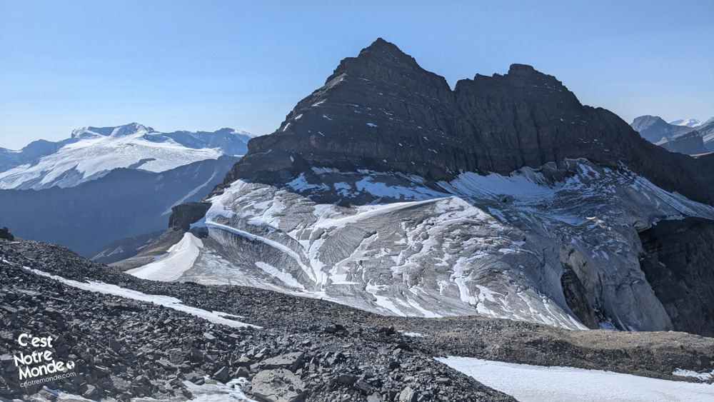
Crossing the Glacier (1 km & 200m Elevation Gain)
The glacier slopes gently down from Mount Owen and is partially covered with rocks, making it more difficult to cross. Put on your crampons and use your ice axe to move cautiously. Steer clear of the rocky areas, as the stones on the ice offer no grip. Once you’ve crossed the glacier, you’ll reach the base of the rocky step—the final section before the summit of Mount Cline.
Navigating the Two Notches and Final Ascent (1.2 km & 345m Elevation Gain)
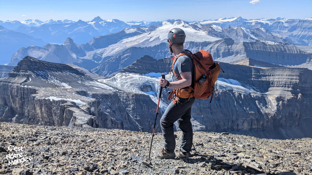
At this point, an airy scramble awaits. A discreet path follows a rocky ridge to the first notch, a vertiginous gap that you’ll need to descend before climbing up the other side of a vertical, but accessible, wall. Anchors allow for a roped ascent (see video 04:35). The second notch, even more imposing, requires rappelling (or taking an exposed route on the left). This one also has anchors. Once you’ve conquered these challenges, a final steep scramble through a scree field brings you to the summit of Mount Cline.
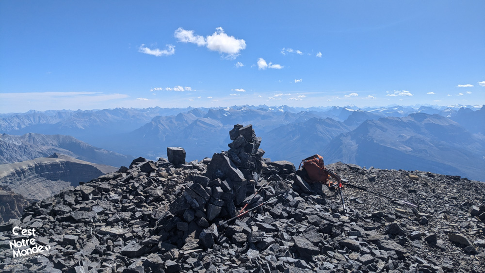
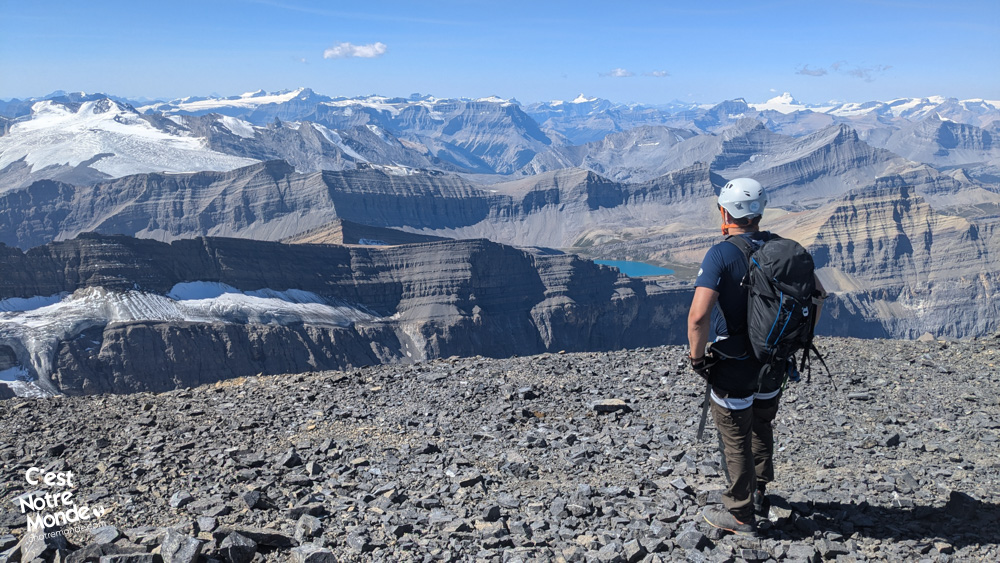
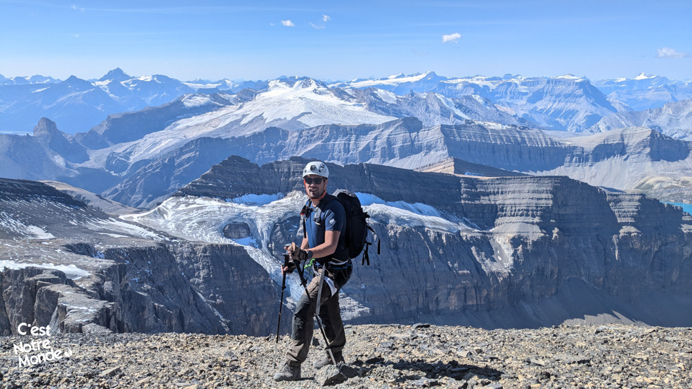
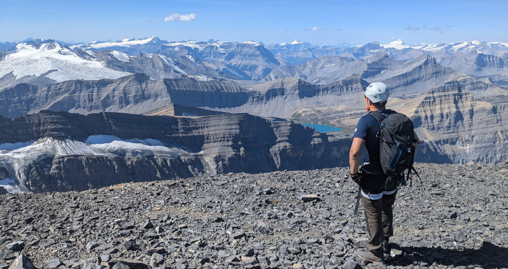
Summit of Mount Cline (3361m)
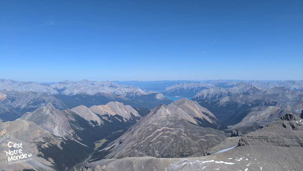
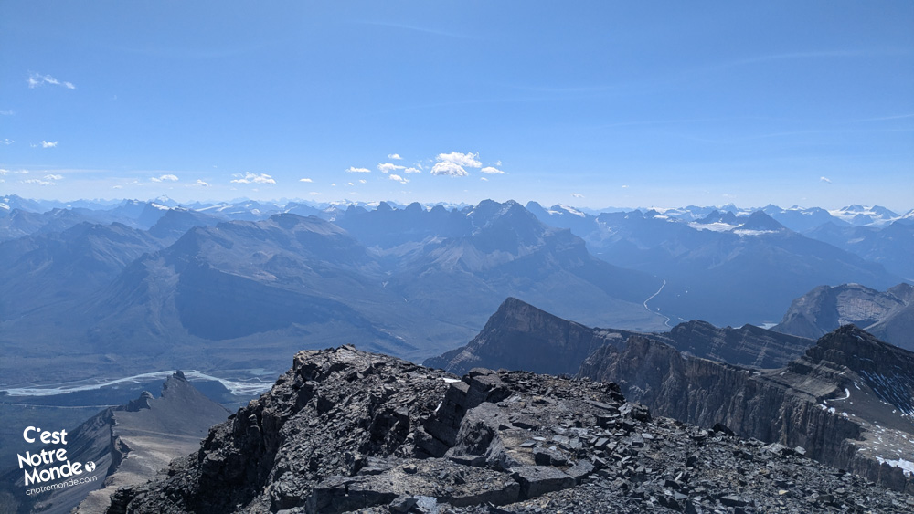
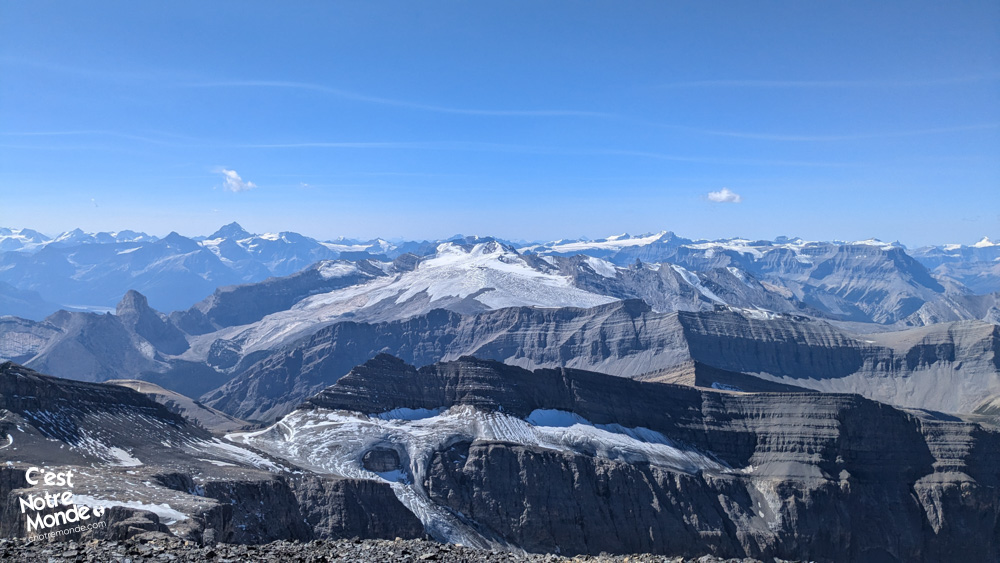
At the summit, you’ll be treated to a stunning 360° panoramic view: glittering glaciers and legendary peaks like Mount Athabasca (3491m), Mount Hector (3394m), and Mount Temple (3544m). This awe-inspiring scenery offers the perfect reward for the effort of the climb.
The Return (11.5 km & 2100m Descent)
The descent follows the same route, meaning you’ll need to retrace your steps through the notches and across the glacier before heading back down toward the lake to collect your bivouac. After that, a long, steady descent leads you back to the parking lot. After such an intense day, be sure to bring a headlamp in case nightfall arrives before your return.
TO KNOW
Interest
Difficulty
Distance
Approximately 23 km / 14.3 miles
Duration
2 days
Elevation
3361 meters / 11,027 feet
Elevation gain
Around 2120 meters / 6955 feet
Useful informations
See on Caltopo (detailed)
See on Google Maps (basic)
Useful links
Parking: https://maps.app.goo.gl/HQ8jgWtpFpav8sMD7
Weather forecast: https://www.mountain-forecast.com/peaks/Mount-Cline/forecasts/3361
Download GPX: https://www.cnotremonde.com/gpx/Mount-Cline-AB-cestnotremonde.gpx