 Alberta
Snow Peak via Burstall Pass
Introduction
A must-do for hikers in the Canadian Rockies, we invite you to explore the breathtaking Snow Peak via Burstall Pass. Nestled in Kananaskis Country, Alberta, this hike is a true gem and a favorite of C’est Notre Monde. And if you’re up for an extra challenge, why not extend your adventure by summiting Snow Peak at 2,789 m? A thrilling experience packed with jaw-dropping views of the region. Simply put, this is one hike you don’t want to miss!
3D interactive map
Getting to Burstall Pass trailhead
Parking access to Snow Peak hike: https://maps.app.goo.gl/RyL26nNr3BB658JC8
From Calgary: 160 km – 2h driving time
Take the Trans-Canada Highway AB-1 West towards Banff for about 66 km, then take exit 118 towards Kananaskis Country. Follow AB-40 South for 55 km before turning right onto AB-742 towards the Kananaskis Lakes. After 2.5 km, turn right again towards Spray Lake Reservoir. Continue on this road for 20 km; a sign will indicate the parking area for the Burstall Pass trailhead, located on your left.
Helpful information
To enjoy your hike, you must:
Be Equipped:
- Hiking boots: Essential for proper ankle protection, especially on the steep scree.
- Trekking poles: Highly recommended for descending through rocky terrain.
- Bear spray: Necessary as a last resort, as grizzlies are common in the area.
- Sufficient water and food: The hike is demanding, so it’s crucial to be well-supplied.
Parking: The parking lot is very large, but this hike can be very busy. It fills up quickly.
Information: Access to Kananaskis Country is not free. You will need to register your vehicle(s) online on the Kananaskis park website and purchase a daily or annual pass. Note that the fees are per vehicle and not per hiker, so carpooling is an option. Be mindful of the forecast and visit the park’s website before your hike to find up to date information such as last seen wildlife, trail conditions, etc.
The Hike
Hike to Snow Peak via Burstall Pass
Take the main trail, which runs alongside a small lake or pond. The first part of the hike is a gentle ascent on a wide and well-marked path. For the first 3.8 km (2.4 mi), you will walk through a forest with limited viewpoints, but the views at the end are worth the effort.
Grizzly Bears in the Area: Stay Alert on the Burstall Pass Hike
Burstall Pass is an area frequented by many grizzly bears, making bear safety crucial. Stay alert, make noise while hiking, and carry bear spray at all times, especially when traversing more remote areas of the trail.
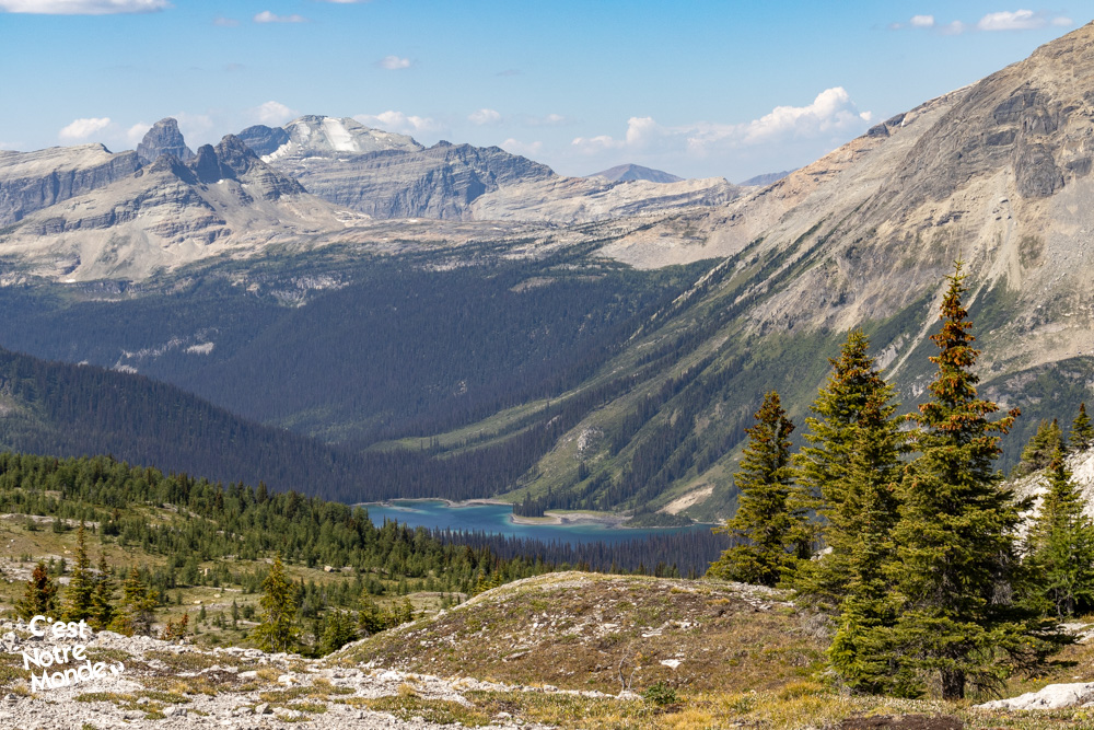
Crossing the Valley
After exiting the forest, you’ll enter a large marshy area. You’ll need to cross several shallow streams and navigate through sometimes slippery and muddy terrain. While this section is not overly difficult, it may slow your progress.
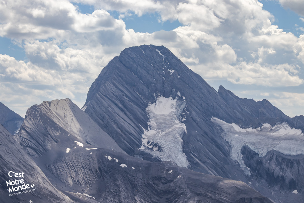
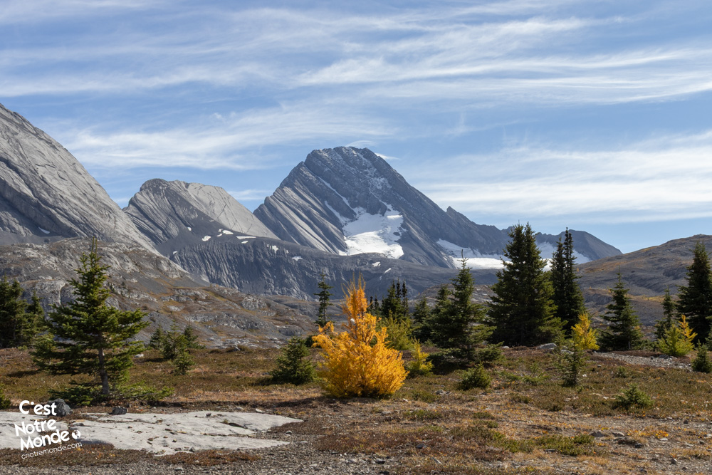
To your left, you will see glaciers descending from Mount Robertson (3,177 m), Mount Sir Douglas (3,406 m), and Mount French (3,244 m), offering a stunning sight as you continue your journey. The immensity of these towering peaks is awe-inspiring and will leave you in awe.
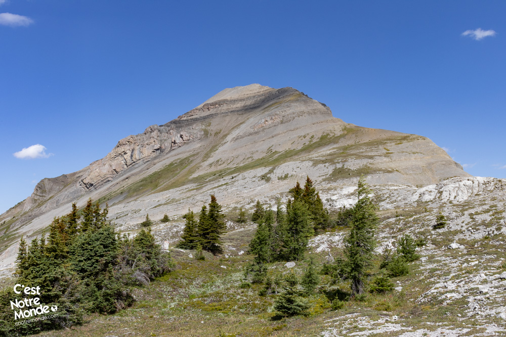
Go to climb to Burstall Pass
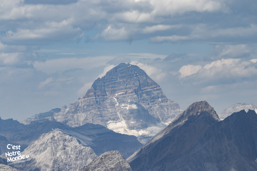
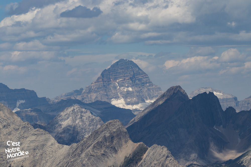
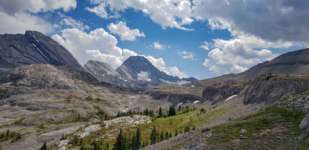
Once across the valley, the trail begins to climb with a steeper slope and a more rugged path. You’ll gradually exit the forest and arrive at Burstall Pass, where you can enjoy colorful rocks, alpine plants, and panoramic views that make the climb worthwhile. As you progress, you’ll cross into Banff National Park, and if the sky is clear, you may catch a glimpse of the iconic Mount Assiniboine, one of Canada’s most famous peaks.
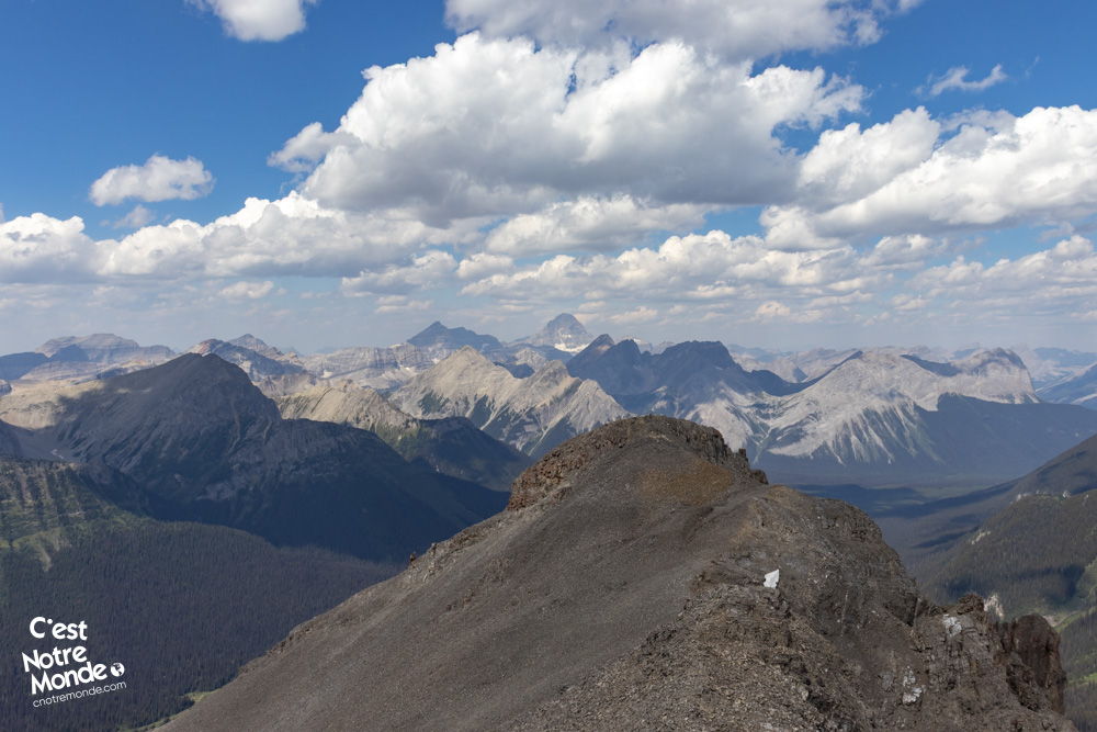
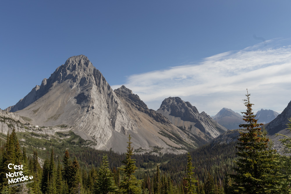
Looking south (left while climbing), you’ll enjoy an incredible view of Mount Sir Douglas. Heading north (right while climbing), you will see your next potential destination: Snow Peak.
Ascent of Snow Peak
If you choose to continue towards Snow Peak, be aware that the trail is poorly marked and may even be nonexistent in places. Using a GPS app is highly recommended to stay on track.
The route is simple: 420 m of elevation gain over about 2 km, primarily along the right side of the mountain (from Burstall Pass). The ascent is on steep scree slopes, but it is manageable for experienced hikers. Along the way, you will encounter a few easy rock steps.
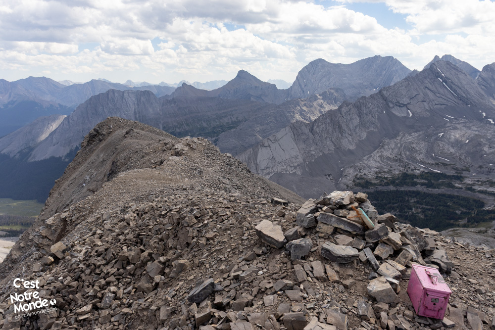
Once at the summit ridge, the difficulty slightly increases due to some exposure on both sides, although the ridge remains relatively wide. A final rock step, which can be bypassed on the left, will take you to the summit of Snow Peak at 2,789 m.
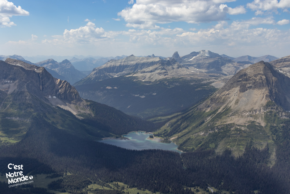
From the summit of Snow Peak, the view is even more stunning than from Burstall Pass, offering unparalleled views of the surrounding mountains, including Mount Smutwood, one of the most popular hikes in the region.
Return to Burstall Pass and the parking
The return journey to the parking lot is the same path you followed on your way up, allowing you to enjoy the spectacular views one last time.
TO KNOW
Interest
Difficulty
Distance
Approximately 19 km / 11.2 miles
Duration
Around 6 or 8 hours
Elevation
2789 meters / 9150 feet
Elevation gain
Around 1000 meters / 3281 feet
Useful informations
See on Caltopo (detailed)
See on Google Maps (basic)
Useful links
Website: https://www.albertaparks.ca/parks/kananaskis/kananaskis-country/
Parking: https://maps.app.goo.gl/7ZPxcepkncFaM8HG7
Weather forecast: https://www.mountain-forecast.com/peaks/Mount-Burstall/forecasts/2740
Download GPX: https://www.cnotremonde.com/gpx/BurstallPass-and-SnowPeak-AB-cestnotremonde.gpx