 New York
Jay Mountain
Introduction
Today, C’est Notre Monde presents a surprising hike on the lesser known Jay Mountain, of the Adirondacks. The Jay Mountain Wilderness Area is situated just North East of the High Peaks region, offering an unobstructed view of the surrounding landscapes. On one side, the Adirondacks, an imposing chain of peaks including Whiteface, Algonquin and Marcy. On the other side, Lake Champlain with Burlington and the Green Mountains nestled in the background.
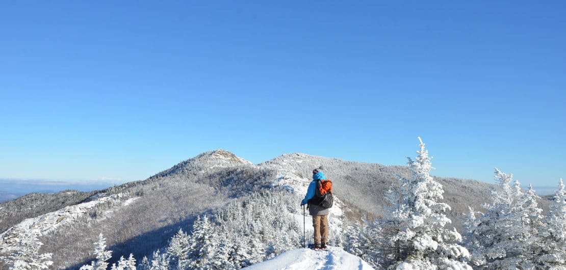
Overall, Jay Mountain is an uncrowded summit with incredible views, and magical snowy landscapes. C’est Notre Monde outlines an easily accessible hike, perfect for those who love solitude and want to discover the splendor of the Adirondacks!
3D interactive map
Things to Know
To enjoy your hike, you must:
Be equipped: Good hiking shoes, a sweater and waterproof clothing in case of rain. In winter, after heavy snowfall, we recommend that you take snowshoes and crampons with you.
Be informed: A sign posted in the parking lot indicates the start of the trail. Information about the trail and the hiker registry is located just a few meters from the starting point.
Parking: Located at the trailhead. Parking is limited, however, so we suggest you arrive early.
The Hike
Once parked, follow the sign that indicates the start of the trail and register at the information panel. The Jay Mountain Trail runs through the forest with an inconsistent climb, allowing hikers to cover a lot of ground quickly. It is only on the last kilometer before reaching the summit that the climb increases rapidly.
When you reach the first intersection, you have the choice of taking the path on the left which leads to an exceptional 360-degree viewpoint of the entire region. On a clear day, you can admire the Adirondack range, Lake Champlain and the Green Mountains. Not to be missed!
To the right of the intersection is where the crest of the Jay Range begins. It is important to know that this trail is not marked, so take care to stick to the path, which can be especially challenging in the winter.
Jay Mountain Ridge
On this trail you will quickly reach some remarkable viewpoints. The first, will offer an exceptional panorama of the Adirondack range with the famous Mont Marcy, Algonquin Peak and the imposing Whiteface Mountain, easily recognizable from the ski slopes carved into its side. Continue for a few meters to reach the first summit of the Jay Range, West Peak, which does not offer the most unobstructed view as you would expect.
Tip: Most hikers turn left at the intersection for the first viewpoint and do not continue to summit of Jay Mountain. Even if access to the path is a little more difficult in winter, the trail along the Jay Range is simply remarkable!
The best part of this hike comes later. Continue until the magnificent clear ridge with a view of Lake Champlain, Burlington and Mount Mansfield (the highest peak in Vermont) in the background. Remember to take some time to rest and admire the view. Continue on to the other side of the ridge to see Camel’s Hump and the Green Mountains. The Jay Range trail continues to the summit, however, in the winter months the ridge is less accessible near the top. At this point, you will have to pass boulders covered in ice and snow, which can be slippery so mind your foot placement and take your time.
A magnificent panorama of the Adirondacks
For the descent, retrace your steps back to the parking lot.
TO KNOW
Interest
Difficulty
Distance
9 km / 5.6 miles
Duration
4 h
Elevation
1027 meters / 3369 feet
Height difference
533 meters / 1748 feet
Useful informations
See on Caltopo (detailed)
See on Google Maps (basic)
Useful links
Website: https://www.dec.ny.gov/lands/100916.html
Parking: https://goo.gl/maps/LzHy38gx6SK2
Weather forecast: https://www.mountain-forecast.com/peaks/Whiteface-Mountain/forecasts/1466